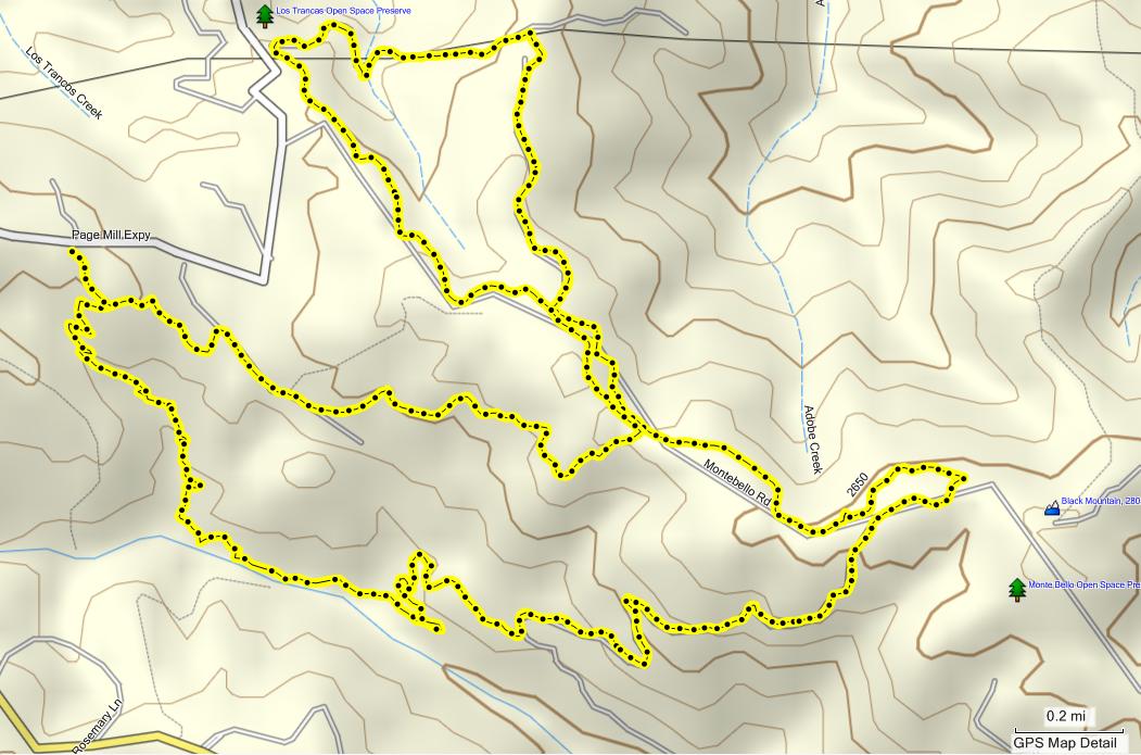
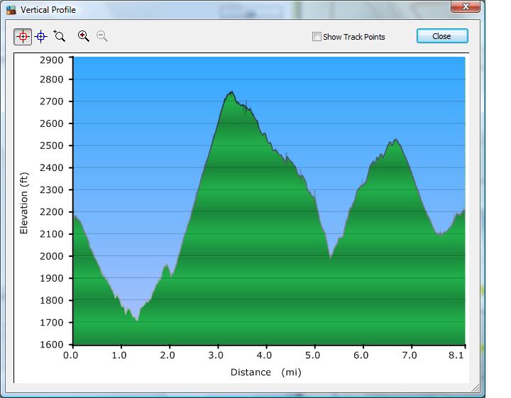
12월 19일, Monte Bello OSP 정기산행 데이터입니다. 8.2 마일정도 걸었는데, 마지막 겹쳐지는 트레일의 거리가 빠진 듯 합니다. (battery 부족으로 일찍 꺼버림 - -:;)


.gif)
 Sam McDonald County Park 산행 후기 (12/26)
 Pleasanton Ridge 산행 데이타 (12/05/09)
1700에서 약 2800 경사가 장난(장량ㅋㅋㅋ)이 아니네요...
수고 많이 하셨습니다 마이송님.
한가지 부탁인데요, GPS file 자체도 올여 주시면
매우 감사감사 ; - ).
다운받아서 저의 GPS에서 사용하며 마이송님과
산악회 횐님들의 발자취을 회상 하고 싶어요. ㅋㅋㅋ
2%님도 다운받아가서 사용하라고 ㅎㅎㅎ.
(2%님 오해마세요 사랑합니다.)